
 by
Time and Date Night Sky Map: How to See the Sky From Any Moment
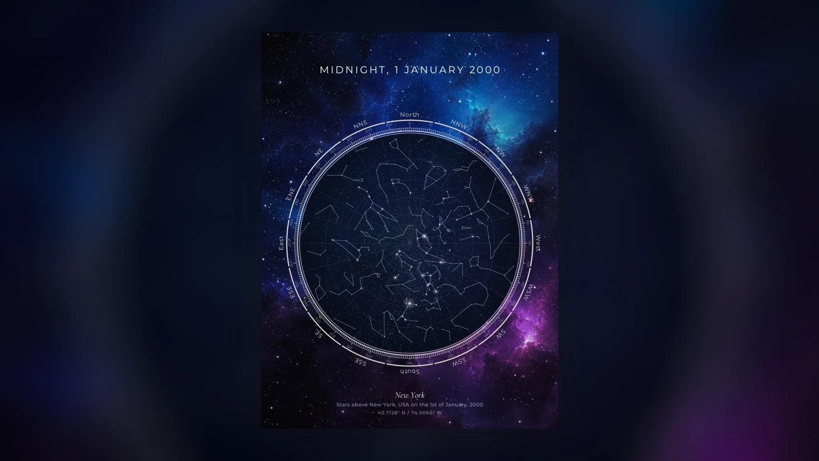
A time and date night sky map shows the stars exactly as they stood above one place at one minute, worked out from three details: the date, the clock time and the location. Because the Earth's spin and its orbit around the Sun are known precisely, the sky for any minute in the past or future can be calculated, not guessed.
This guide explains what goes into that calculation, how much each detail changes the result, the mistakes that put a map hours out, and how to read the finished chart. It also covers the honest question of when you want an interactive tool on a screen and when a printed map is the better answer.
How the sky for a moment is worked out
The stars are so far away that, on a human timescale, they do not move relative to each other. The Big Dipper looked the same to your great-grandparents as it does to you. What changes is our view of them, for two reasons.
The first is the Earth's rotation. Every 24 hours the planet spins once, so the whole sky appears to wheel overhead, rising in the east and setting in the west. The second is the Earth's orbit. Over a year we travel around the Sun, and the side of the planet facing away from it, the night side, looks out at a different part of the sky each season.
Put those two together with your position on the globe and you have everything needed. The date and time fix how far the Earth has turned and how far along its orbit it is; the latitude and longitude fix where you are standing on it. From there it is geometry: for each star, work out its height above your horizon and its direction, then draw the result as a dome seen from below.
Our maps do this for about 9,000 stars, every star bright enough to see with the naked eye, and all 88 constellations, for any date from 1900 to 2100. The accuracy page names the star catalog and explains the limits.
What a time and date night sky map needs
The date
The day, month and year. Be careful with dates near midnight: a moment at 12:30 am belongs to the next calendar day, which is easy to get wrong when you remember it as "the night of the 14th".
The clock time
The more precise, the better, but an hour either way still gives you most of the same sky. If you do not know the time at all, 10 pm is a sensible default for a night that people remember; it is dark in every season at most latitudes and the sky is at its most familiar.
The place
A city is enough for almost every purpose, because the sky above a whole city is effectively identical. Exact coordinates matter only if you want the map precise to the building, and most tools, ours included, accept either.
What changes the map, and by how much
Not all three details are equal. Knowing which ones matter most saves you worrying about the wrong thing.
The hour: about 15 degrees of sky every hour
The sky turns a full circle in about 24 hours, which works out at roughly 15 degrees an hour. Over a whole night that is enormous. Constellations that are just rising in the east at 9 pm are high overhead by 2 am and setting in the west by dawn, so maps of the same date at those two times look like different skies.
Over a few minutes it is small. A difference of 10 or 20 minutes moves everything by a few degrees, which nobody will spot on a printed poster. This is why "around 10 pm" is a perfectly good answer for a map and "10:07 pm exactly" is a nice detail rather than a necessity.
The date: four minutes earlier every night
Because the Earth moves along its orbit as well as spinning, the stars rise about four minutes earlier each night than the night before. Over a month that adds up to two hours, and over a season to six. That is why the winter sky and the summer sky at the same clock time are so different: in December, Orion is high at midnight; in June, the same constellation is above the horizon only in daylight. Our article on why the stars look different in summer and winter goes into this properly.
The year matters far less than the day. The same date and time in 1985 and 2025 give almost exactly the same star positions, because the slow wobble of the Earth's axis shifts the sky only about one degree every 70 years.
The latitude: which stars are ever up
Your distance north or south of the equator decides which part of the sky is ever above your horizon. The height of the celestial pole above your horizon equals your latitude, so from New York, at about 41 degrees north, the Pole Star sits about 41 degrees up and the stars near it never set. From the equator the Pole Star sits on the horizon; from Sydney it never rises at all.
The southern sky works the other way. The Southern Cross never rises above the horizon from most of the continental United States; from the Florida Keys and Hawaii it peeks over the southern horizon in spring. Our guide to seeing the Southern Cross covers where and when. For a map, this means the same date and time drawn for London and for Cape Town will share almost no constellations.
The longitude: mostly a matter of clock time
Moving east or west changes the time zone more than the sky. Two cities on the same latitude see the same stars, just at different moments of the day. The calculation takes care of it, provided the time you enter is the local time at that place.
A worked example: midnight, 1 January 2000
Take one famous minute, the turn of the millennium, above New York. The date is 1 January 2000, the time is 12:00 am local time, and the place is the city, at about 40.7 degrees north.
At that minute the winter sky is at its best. Orion stands high in the south, just past its highest point of the night, and Sirius, the brightest star in the sky, sits below and to the left of it, close to its own highest point. The Big Dipper is in the northeast, standing on its handle. That is the sky the map draws.
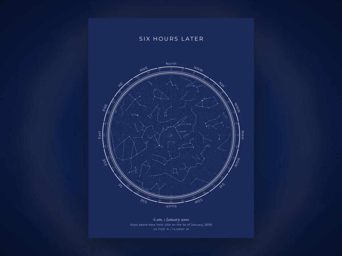
Now change only the time, to 6 am the same morning, and nothing else. Six hours is 90 degrees of turning. Orion has set in the west; the Big Dipper is high in the north, almost overhead; Arcturus, the bright orange star of spring evenings, is high in the southeast. Same place, same date, a different sky. The two pictures in this article show both moments side by side.
If you would like to look up more moments like this, our article on star maps of famous dates has several, from the moon landing to the night the Berlin Wall fell.
The mistakes that put a map hours out
Almost every wrong sky map comes from the time, not the stars.
- Entering UTC or your home time zone. Use the clock time at the place itself. If you met in Rome but live in Boston, the time to enter is what a watch in Rome would have said.
- Forgetting daylight saving. A good tool works out daylight saving for the place and the date on its own, including years when the rules were different. Converting by hand is where errors creep in.
- The wrong side of midnight. "The night of 31 December" at 12:20 am is 1 January.
- Using the city you live in now. For a birth, use where the birth happened; for a first meeting, where you actually met.
Our designer reads the time as local to the place you pick and handles the time zone and daylight saving itself, so you type what the clock said and nothing else.
Reading the map once you have it
A circular sky map shows the whole dome of the sky above one spot, flattened onto a disc. Three things make it readable.
The centre of the circle is the point straight overhead, called the zenith, and the edge of the circle is the horizon all the way round. A star near the middle was high in the sky; a star near the edge was low, just above the rooftops or the sea.
The compass points are reversed from a road map. East is on the left and west on the right, because a sky map is meant to be held above your head, looking up. Lie on your back with your head to the north and the map matches the sky.
The lines join the stars of each constellation into their traditional shapes. They are a drawing aid, not something in the sky, and most designs let you turn them off. Our step-by-step guide to reading a star map goes further, including how to find the Pole Star and the brighter named stars.
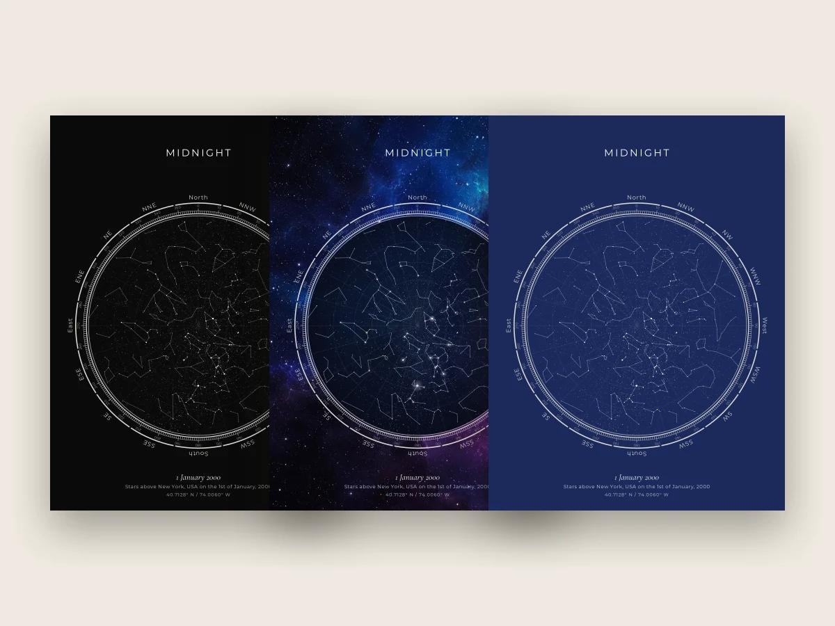
An interactive map or a printed one
Both start from the same calculation. They are good at different things.
An interactive planetarium app or website is the right tool if you want to go outside tonight and find something: it updates as you move, zooms, shows the planets and the Moon, and costs little or nothing. Free planetarium software such as Stellarium does this very well. If your question is "what is that bright light over the trees right now", a printed poster is the wrong answer and an app is the right one.
A printed map is for a moment that has already happened and that you want to keep: a birth, a first meeting, a wedding, the night someone died. It fixes one minute in a form you can hang on a wall or give as a gift, with the date and words beneath it. Our article on what the sky looked like on your birthday walks through one example from start to finish.
If that is what you are after, the designer works out the sky for your date, time and place in the browser, free, and shows the finished map before you pay anything. It has fourteen designs, from the photographic Galaxy to the plain black Noir. The digital files are $25 and arrive by email in minutes: a 300 DPI PNG and a print-ready PDF in 12x16, 18x24 and 24x36. Framed prints are $69, $109 and $179 by size, in a black wood frame with an acrylic front, with free shipping to the US and 40+ countries and delivery in 7 to 12 business days. Every order has a 14-day money-back guarantee.
It is not the right purchase if you want to learn the sky night by night, or to see the planets and the Moon, because our maps show the stars and constellations of one fixed moment and leave the wandering bodies out. For that, start with an app and come back when there is a moment worth keeping. The custom star map page has the full set of options when you do.
Frequently asked questions
Can I see what the night sky looked like on a specific date and time?
Yes. The positions of the stars for any minute can be calculated from three details, the date, the time and the place, because the Earth's rotation and orbit are known precisely. Planetarium software and star map designers both do this. Our designer works for any date from 1900 to 2100 and shows the sky above your chosen place at your chosen minute, free, before you buy anything.
How much does the time of night change the sky?
A lot over a night and very little over a few minutes. The sky turns about 15 degrees an hour, so constellations rise in the east and set in the west through the night, and a map at 9 pm and one at 3 am look clearly different. A difference of ten or twenty minutes moves everything only a few degrees, which is hard to spot on a printed map.
Does the location matter as much as the date?
For which stars you can see, yes. Your latitude decides which part of the sky is ever above your horizon: from New York the Pole Star sits about 41 degrees up and the Southern Cross never rises, while from Sydney the reverse is true. Moving a short distance, across a city or to the next town, makes almost no visible difference.
What time should I enter, local time or UTC?
Enter the local clock time at the place you chose, the time people there would have read on their watches. A good tool works out the time zone and daylight saving for that place and date on its own, which is how ours works. Converting to UTC yourself first is a common mistake that shifts the whole sky by several hours.
Is a sky map for a date the same as a horoscope or birth chart?
No. A sky map shows the real positions of the stars and constellations as an astronomer would calculate them. A birth chart is an astrological diagram built around the Sun, Moon and planets in the zodiac signs, drawn to a different set of conventions. The two use some of the same names, but they are different things made for different purposes.