
 by
by How to Read a Star Map (Beginner's Guide)
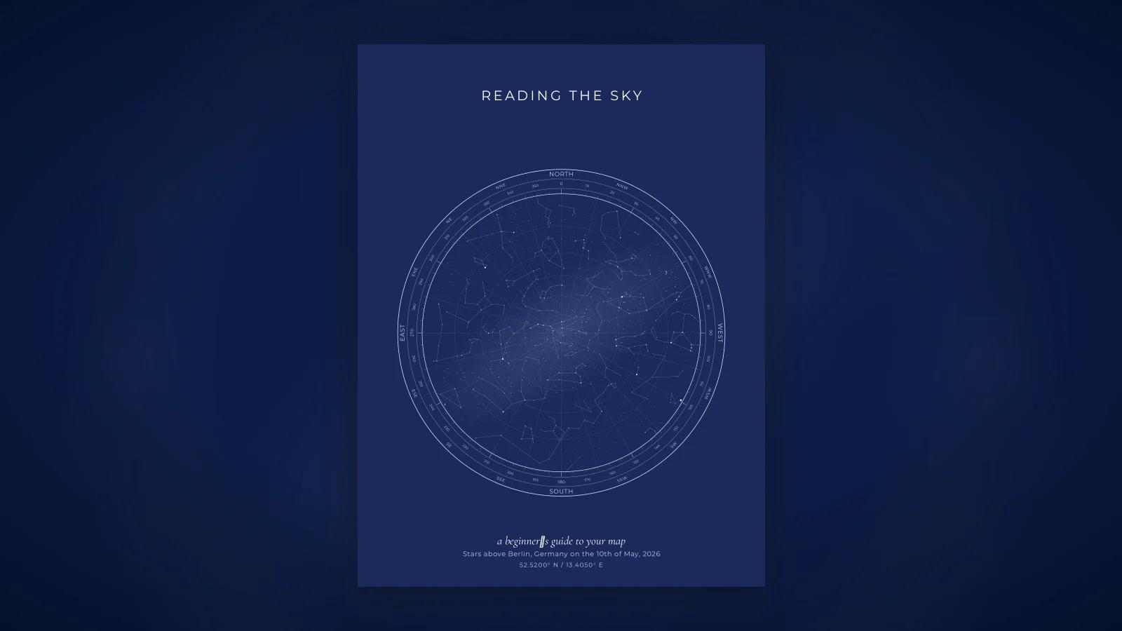
A star map looks simple: a circle full of dots, some lines, a few letters round the edge. Then you try to match it to the sky and realise east is on the wrong side, the constellation you know is upside down, and the star you were told is famous is not the big one. None of this is a mistake. A star map has its own conventions, and once you know them it reads as easily as any other map.
This guide takes the elements one at a time, in the order you meet them.
The circle is your horizon
Start with the outline. The big circle is not a decorative frame; it is the horizon, the line where sky meets ground, drawn all the way round. Every point on the edge of the circle is a point on the horizon in some compass direction.
That means anything drawn near the edge was low in the sky at the mapped moment, just above the rooftops or the hills. Anything drawn near the middle was high up. A constellation half inside and half outside the circle was in the act of rising or setting.
Skies are hemispheres, and a flat disc cannot hold a hemisphere without stretching something. Most star maps, ours included, use a stereographic projection. It keeps the shapes of constellations faithful, which is the thing you care about when trying to recognise them, at the cost of making things near the horizon a little larger than things overhead. The stretching is modest and you will not notice it in practice.
The centre is the zenith
The exact middle of the circle is the zenith: the point directly above your head. Stand outside, look straight up, and you are looking at the centre of the map.
One consequence catches people out. Polaris, the North Star, is not at the centre of a star map unless the map was made for the North Pole. From New York, Polaris sits about 41 degrees above the northern horizon, so it appears on the map roughly halfway between the centre and the northern edge. From London it sits a little higher, from Miami a little lower. Its height above the horizon equals your latitude, which is how sailors used it.
Why east and west are swapped
This is the single most common confusion, so it is worth a full explanation.
On a ground map, north is up and east is to the right, because a ground map imagines you floating above the land looking down. A star map imagines the opposite. You are lying on your back, or holding the sheet above your head, looking up.
Try it. Face north. East is on your right, as on a road map. Now tilt your head back and keep looking up until you are looking at the zenith. North is still ahead of you, at the top of your view, but the sky to your east is on your left. The act of looking up, rather than down, mirrors the picture.
So a star map with north at the top has east on the left and west on the right. Our maps are drawn this way, with the compass labels reading N at the top, E at the left, S at the bottom and W at the right. It is not reversed; it is a look-up chart. Hold it overhead with north toward north and everything lines up.
The compass ring
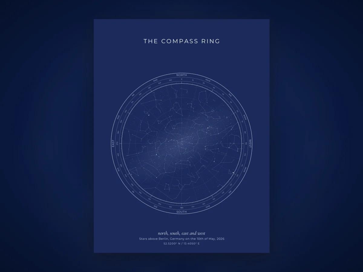
Around the horizon circle runs a ring of directions. Ours carries the four cardinal points, the four intercardinal points (NE, SE, SW, NW), and the eight in between (NNE, ENE and so on), sixteen in all, with small degree ticks between them. The ring answers the question "in which direction was that star?"
To use it, find a star or constellation on the map and follow a straight line from the centre outward through it to the ring. The label where the line meets the ring is the compass direction you would have faced to see it. The distance from the centre tells you how high it was. Together those two numbers, direction and height, are how astronomers describe where something sits in the local sky. They call them azimuth and altitude.
Dots are stars, and size is brightness
Every dot on the map is a star, placed where it actually was at the mapped minute. The dots come in different sizes, and the size stands for brightness, not physical size and not distance.
Brightness is measured on the magnitude scale, which is old, backwards, and worth knowing. The Greek astronomer Hipparchus ranked stars from first magnitude (the brightest) to sixth (the faintest he could see). Modern astronomers kept the scale and made it precise: a difference of five magnitudes is a factor of exactly one hundred in brightness, so each step is about two and a half times. Lower numbers are brighter. The brightest star in the night sky, Sirius, is so bright it has a negative magnitude, around minus 1.5. The faintest stars visible to a good eye under a truly dark sky are around magnitude 6 to 6.5.
A star map that plots stars "to magnitude 6.5" is therefore drawing roughly what a person with good eyes far from city lights could see. Ours plots about 9,000 such stars from the HYG catalog; the accuracy page has the details. The biggest dots on the map are the handful of stars around magnitude 0 or 1. The tiny specks are the fifth- and sixth-magnitude stars you would only notice from the countryside.
This is also why the famous star is often not the biggest dot. Polaris is about magnitude 2, a modest star that happens to sit near the pole. On a map it is a middling dot with a lot of empty sky around it. Sirius, Vega, Arcturus and Capella are the ones that leap out.
The lines are constellations, not the stars
Straight lines link some of the dots into figures. These are constellation lines and they are a convention, drawn to help the eye pick out the traditional shapes. No such lines exist in the sky. Different atlases join the same stars slightly differently; there is no single official set, though most modern maps follow one of a few standard patterns. The IAU defines the 88 constellations by their boundaries and names, not by any particular set of lines.
The stars are the data. The lines are a guide. A map with the lines switched off shows exactly the same sky; it is just harder for a beginner to find Orion in it.
Some maps also print the constellation names near their figures. Names help enormously when you are learning, and clutter the picture once you know it, which is why they are usually a toggle.
Where a map does not label individual stars, and ours does not, you identify a bright star by its constellation. The brightest star in Lyra is Vega; the bright red one at Orion's shoulder is Betelgeuse. A list of the brightest stars with their constellations makes this quick.

The grid
Many star maps carry a faint grid inside the circle. There are two kinds, and it matters which one you are looking at.
An equatorial grid, of right ascension and declination, is fixed to the stars. It is the sky's equivalent of longitude and latitude, and it is what you find in a star atlas meant for any night and any place. On a map of a single moment it looks like a set of curved arcs, tilted according to your latitude.
A horizon grid, of altitude and azimuth, is fixed to the observer. It looks like a target: concentric circles of equal height above the horizon, crossed by straight spokes running from the zenith to the compass ring. This is the grid on our maps. The circles are drawn every 15 degrees of altitude, so the first circle inside the edge is 15 degrees up (about a hand and a half at arm's length), the next 30, and so on to 75 near the centre. The spokes are drawn every 15 degrees of azimuth and match the compass ring.
The horizon grid is the natural one for a map of a specific moment, because it answers the question the map exists to answer: from where I stood, how high and in what direction was that star.
The Milky Way band
A soft, pale band arching across part of the circle is the Milky Way, the combined light of the disc of our own galaxy. It is fixed among the stars, so its position on a map is exact for the moment. Its shape and brightness on paper are necessarily an approximation of something diffuse and irregular.
On a northern summer evening the band runs high overhead from roughly northeast to southwest, through Cygnus and down toward Sagittarius. On a northern winter evening it is fainter and passes through Auriga and Orion. If your map shows no band at all, either the maker leaves it off or, from your location and hour, it lay mostly along the horizon.
Orienting a printed map against the real sky
The test of a star map is holding it up outdoors. The procedure is short.
- Go out at a time close to the one on the map, on or near the date. The sky repeats itself to within a few minutes on the same date each year, so a map of a birth in 1994 still matches the sky on that birthday.
- Face north. Hold the map over your head, printed side down, with the N of the compass ring pointing north. East on the map now falls on your left, which is where east is.
- Look at the centre of the map and then straight up. The stars should correspond.
- If you would rather face a particular constellation, say Orion in the south, turn the map so S is toward you. The map's left is then west and its right is east, exactly matching the sky in front of you.
A dim red torch helps you read the map without spoiling your night vision. Give your eyes ten minutes to adapt and the faint stars on the map begin to appear in the sky as well.
Common confusions, briefly
"The map is backwards." It is a look-up chart. Hold it overhead. See above.
"My constellation is upside down." Constellations have no correct way up. Orion stands upright when he is in the south and lies on his side when rising in the east. A map shows the orientation for that moment, which may not be the picture-book one.
"Polaris is not in the middle." The centre is the zenith, not the pole. Polaris is as high above the northern horizon as your latitude.
"Where are the Moon and the planets?" Most fixed star maps, including ours, plot only stars, because the Moon and planets move against them from night to night. If they matter to your moment, check a planetarium app.
"I cannot find the Big Dipper." It may be below the horizon at the mapped time, especially from the southern United States in autumn evenings, or you may be looking for the wrong size. The Dipper is large, about 25 degrees across, and low in the north on autumn evenings from mid-northern latitudes.
Seeing it for a date that matters
Everything above applies to any star map. If you want to try it with a sky of your own, our designer draws the map for any date, time and place since 1900 free in the browser, with the compass ring, the grid, the constellation lines and the Milky Way each on a toggle so you can see how each layer changes the reading. Some people start with the sky over their own birthday, which is as good a first map as any; others go straight for a wedding night or an anniversary and pick a design like navy once they can read what the rings and lines mean.
Frequently asked questions
Why are east and west swapped on a star map?
Because a star map shows the sky as seen from underneath, looking up. A ground map is drawn as if seen from above. Hold a star map over your head with north pointing north and east falls on your left, where east actually is when you face north and look up. The map is correct; it is simply not a floor plan.
What is the circle on a star map?
The circle is your horizon, all the way round. The edge is the ground line in every direction, and the centre of the circle is the zenith, the point straight overhead. Anything drawn near the edge was low in the sky at that moment; anything near the middle was high.
Why are some stars drawn bigger than others?
Size stands for brightness. Astronomers measure brightness on the magnitude scale, on which lower numbers mean brighter stars. A magnitude 1 star is about a hundred times brighter than a magnitude 6 star, which is roughly the faintest the naked eye can see under a dark sky. Bigger dot, brighter star. Size has nothing to do with the star's physical dimensions or distance.
What are the lines between the stars?
Constellation lines. They are conventions, not anything visible in the sky, drawn to help the eye pick out the traditional figures. Different atlases draw them slightly differently. The stars are the data; the lines are a guide.
How do I hold a printed star map up to the real sky?
Go outside at a time close to the one on the map, face north, and hold the map above your head with the N of its compass ring toward north. The stars overhead should match the centre of the map. If you face south instead, turn the map so S is toward you; east and west then fall correctly on your left and right.